Gathering NOAA and NWS conditions across five Great Lakes.
— / 15sites with usable dataLive update pending
Explore the shore
Choose a place to watch
Click a map marker or select a shoreline below. Each score requires a recent offshore water-temperature grid cell and an hourly forecast. During ice season it also requires a recent local ice analysis.
Great Lakes shoreline geometry: Natural Earth (public domain)
Strong setup Possible Data unavailable
Keyless Great Lakes shoreline map
15 Great Lakes lookouts
Your selected shoreline · Lake Huron
Saginaw Bay / Bay City
Awaiting data
Best upcoming morning
—Awaiting trustworthy inputsNo viewing prediction available
A lake smoke outlook requires recent NOAA lake-water temperatures, an NWS hourly forecast and, during November–May, recent local ice concentration.
Lake surface—
Forecast air—
Water warmer by—
Wind at best hour—
Open-water checkWaiting for ice status
Ice concentration is assessed separately during the cold season.
Viewing area: Saginaw Bay shoreline · shallow-bay temperatures can change rapidly. Check opening hours, shoreline conditions and access before leaving.
Next 72 hours
Morning-by-morning comparison
The morning outlook will appear when both recent local water temperature and hourly weather forecasts are available. No estimated scores are shown without those sources.
Highest-scoring forecast hour between 5–10 a.m. each morning; no claim of observed fog. This index is experimental and is not a probability. A nearby-buoy value is an explicitly labelled proxy rather than a local satellite pixel.
Before you make the drive
Watch the shoreline camera
6 operator-published embedded players across the Great Lakes. Select a shoreline below. These are links to live services, not independently verified live pictures.
Selected location · Saginaw Bay / Bay City · Camera sources reviewed 2026-10-17
Saginaw River Cam — Smith Park, Essexville
Camera operator: Saginaw River Cam / City of Essexville
View: Saginaw River near its mouth, NOT open water of Saginaw Bay
Loads only on request; no background videoProvider may require another click or may be offline
This nearby river camera cannot verify conditions across the open Saginaw Bay surface.
These camera sources are operator-published, but the tool does not check whether video is playing today. Some cameras show sheltered harbors or a river, not open-lake visibility. Video is not copied, recorded or automatically analyzed.
What to look for on the camera
Wisps rising from water: shallow, curling plumes over exposed open water, rather than a uniform cloud deck.
Wind and direction: does the steam drift or shear toward the shore? Compare with the forecast.
Image timestamp: a frozen webcam frame from yesterday cannot verify today’s conditions.
A plausible camera view remains a visual clue, not a confirmed scientific observation. Check current marine advisories before going.
Different from fog formation
Which way will the wisps drift?
A directional view guide, not a live fog observation or navigation forecast.
Forecast shoreline drift
No ranked viewing window
Wind direction unavailable. No plume movement is assumed.
An ice-safe water/air setup must be available before wind is ranked.
Wind from—
Approx. open water—
Wisps could move—
Bearing to open water uses the mapped offshore sample point. Shoreline curves, harbors and winds over the lake may differ from the NWS shoreline forecast.
Best forecast viewing hours · 5–10 a.m.
Three-morning drift outlook
No direction-qualified morning is available. This may mean no strong enough lake-smoke setup, missing wind directions, very light or strong winds, or the existing winter ice gate. An unavailable view is not a poor view.
View hours require setup score at least 50 and within 15 points of that morning’s best setup. Among those hours, along-shore drift comes first, then shoreward, then lakeward. This is a qualitative photography preference, not scientifically calibrated sighting probability.
A growing historical record
What did the forecast say?
Saved forecasts issued the previous day. This is an archive of predictions—not confirmed lake smoke or a retrospective reconstruction.
Saginaw Bay / Bay City
Next-morning forecast archive
Checking the historical forecast archive…
What this history can show: how frequently the experimental atmospheric setup index flagged favorable conditions, when ice or missing data interrupted forecasts, and whether the tool anticipated cold-air outbreaks. It cannot establish actual lake-smoke frequency or predictive accuracy without independent observations.
Evidence, not assumption
Did anyone actually see it?
A forecast is not a sighting. Only a dated, location-specific lake-smoke record that has been manually reviewed and linked to its original source can appear here.
Checking reviewed evidence…
Evidence rules
Reports need a precise location, observation date/time, original photo, camera record or official source, and an independent editorial review. Generic fog reports, an unavailable webcam, and forecast scores never become confirmed sightings automatically.
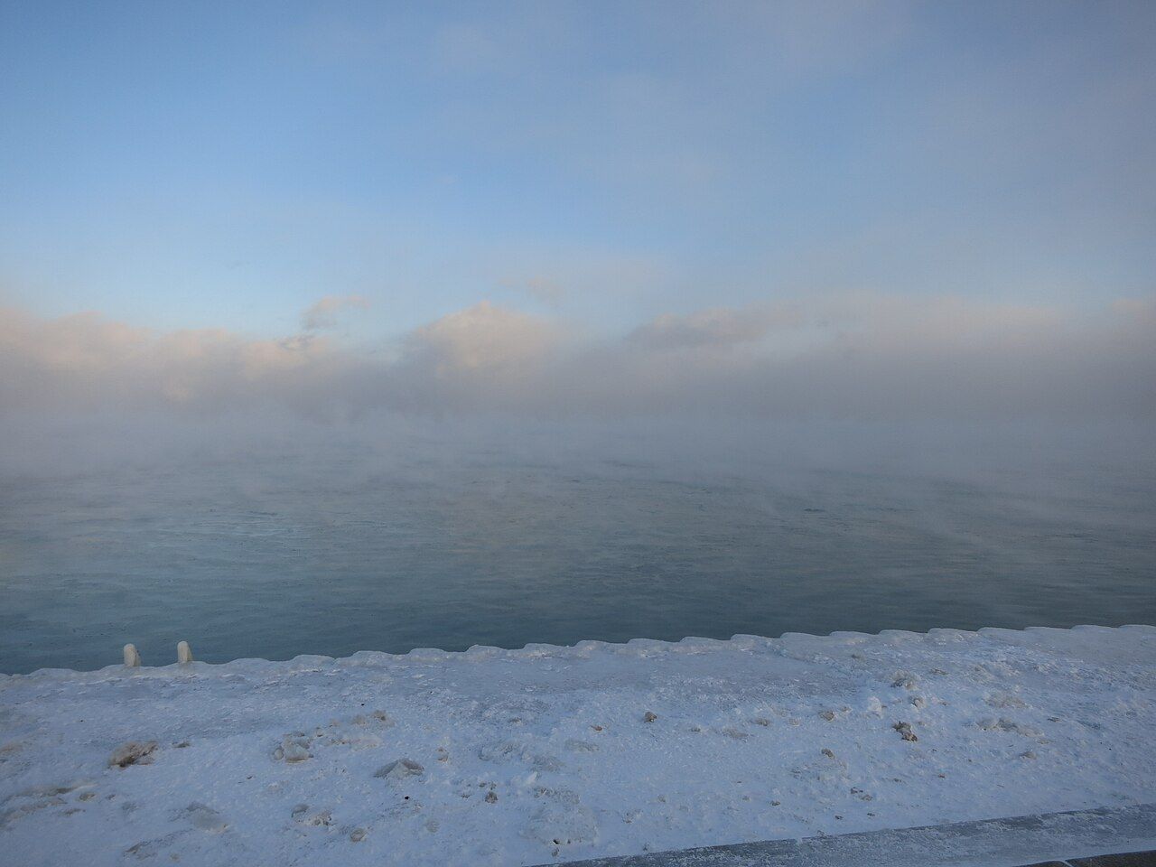
This is steam fog, not wildfire smoke and not the same setup as typical warm-air-over-cold-water fog.
01
Lake stays relatively warm
Great Lakes water loses heat slowly. When a cold front arrives, open water can be much warmer than the air above it.
02
Cold air draws moisture
Water evaporates into the colder air. Close to the surface, that moisture condenses into wisps of visible steam fog.
03
Wind shapes the spectacle
A light breeze helps move cold air across the water. Stronger wind can mix and disperse the fog, while shore geography adds uncertainty.
Safety before photography. Lake smoke can coincide with cold outbreaks, waves, ice and rapidly changing visibility. Do not use this viewing index for boating or navigation. Check NWS marine forecasts and local advisories.
Lake smoke questions
What is lake smoke?
Lake smoke, also called steam fog, occurs when cold air moves over warmer unfrozen lake water. Evaporation into the cold air can create wisps or columns of condensation that look like smoke.
When is lake smoke most common on the Great Lakes?
Late fall and early winter cold-air outbreaks can create strong lake smoke conditions while water remains relatively warm and unfrozen. It can occur at other times when the temperature contrast is large enough.
What is the best time of day to see lake smoke?
Early morning often offers dramatic lighting and lower angles of sunlight, but lake smoke can occur at any hour during a cold-air outbreak. This planner compares forecast hours from 5 to 10 a.m. local time.
Is lake smoke the same as ordinary lake fog?
No. Lake smoke needs relatively warm water under colder air; common advection lake fog occurs when warm humid air flows across colder water.
Does a high setup score mean I will see fog?
No. Scores only describe a simple combination of temperature contrast, wind and weather. They are not observed fog, a probability, or a forecast of visibility.
Where do the lake-water readings come from?
The primary readings come from NOAA GLSEA satellite-analyzed pixels. If NOAA ERDDAP is unreachable, the predictor separately samples the published GLSEA full-resolution daily map at the selected offshore cell. The daily file modification timestamp indicates source publication, not a direct observation. If both satellite routes fail, a nearby same-lake NDBC buoy may be used with station and distance disclosed. A forecast is withheld when none of these sources are trustworthy.
Why does a location show a nearby buoy instead of satellite water temperature?
NOAA GLSEA coastal pixels can be unavailable or temporarily unreachable. When that happens, the tool may use a recent NOAA NDBC water-temperature measurement from a buoy on the same lake within 55 km of the viewing location. A buoy measures water below the surface, often about 1 meter deep, and can differ from temperature near the shoreline. These proxy readings are identified by station and distance; without a trustworthy nearby observation, the location stays unavailable.
How do ice conditions affect the lake smoke forecast?
Lake smoke requires exposed liquid water. From November through May, the tool uses NOAA GLSEA/National Ice Center local ice concentration to prevent false strong ratings. If the data are stale or missing, no score is shown. Patchy ice can limit a rating even where nearby open water remains.
Can a shoreline webcam confirm lake smoke?
A camera can help a person check for moving wisps above exposed water, but video may be dark, unavailable or pointed toward the harbor rather than open lake. We link to original camera operators; no automated camera analysis or confirmed sightings are claimed.
How does wind direction affect where lake smoke is visible?
A National Weather Service wind direction names the direction the wind comes from. By comparing that with an approximate bearing from the selected shore toward open lake water, the planner describes whether fog wisps may move along the shore, toward the shore, or out over the lake. These are qualitative clues, not measured fog motion or visibility guarantees.
Are historical forecast scores proof that lake smoke happened?
No. The archive preserves what the NOAA/NWS weather-based tool predicted for the following morning, at the time the prediction was issued. Scores are not observations, probabilities or measures of how often lake smoke actually appeared. Dated, reviewed camera or field evidence is tracked separately.
Is it safe to watch lake smoke from a pier or boat?
Cold air outbreaks can bring dangerous waves, ice and reduced visibility. Watch from designated, open shoreline areas and always follow National Weather Service marine advisories. Avoid exposed piers and boating in hazardous conditions.